First Ascents 1981
One year
21 FA Peaks
On 11 Quads
* 26Apr The Supervisor'(6280+) USGS Damnation Peak
* 26Apr Wireman' (6120+) USGS Damnation Peak
* 26Apr Senior Operator' (6080+) USGS Damnation Peak
* 26Apr Machinist' (6040+) USGS Damnation Peak
* 31May Styloid Peak' (6972) USGS Ross Dam
* 31May Distal Phalanx' (7615) USGS Ross Dam
* 31May Hook of the Hamate' (7480+) USGS Ross Dam
* 3Jul Tara Peak' (6723) USGS Downey Mountain
* 11Jul Dirk Peak' (7640+) USGS McAlester Mountain
* 27Jul Devils Toothpick' (7720+) USGS Mount Spickard
* 28Jul W by NW Mox' (8280+) USGS Mount Redoubt
* 15Aug The Sacrum' (7148) USGS Eldorado Peak
* 15Aug Pancake Pinnacle'(7080+) USGS Eldorado Peak
* 23Aug Hoot Owl, S Pk' (7960+) USGS Mount Arriva
* 23Aug Hoot Owl, N Pk' (7920+) USGS Mount Arriva
* 14Sep Derci Spire' (8000+) USGS Mount Arriva
* 14Sep Obsession Spire' (7360+) USGS Mount Arriva
* 15Sep Natal Peak' (7800+) USGS Mount Arriva
* 17Sep Zebra Spire' (8000+) USGS Goode Mountain
* 17Sep V Peak' (8000+) USGS Mount Logan
* 25Oct Ezekiel' (7521) USGS Crater Mountain
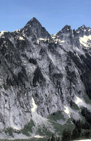
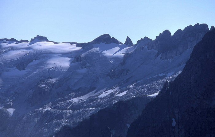
The Supervisor'
The central spire right of the high point of Electric Butte.
The names around Electric Butte honor the Skagit powerhouse journeymen.
April 26, 1981
FA Party: John Roper and Silas Wild
Wireman'
April 2, 1981
FA Party: John Roper and Silas Wild
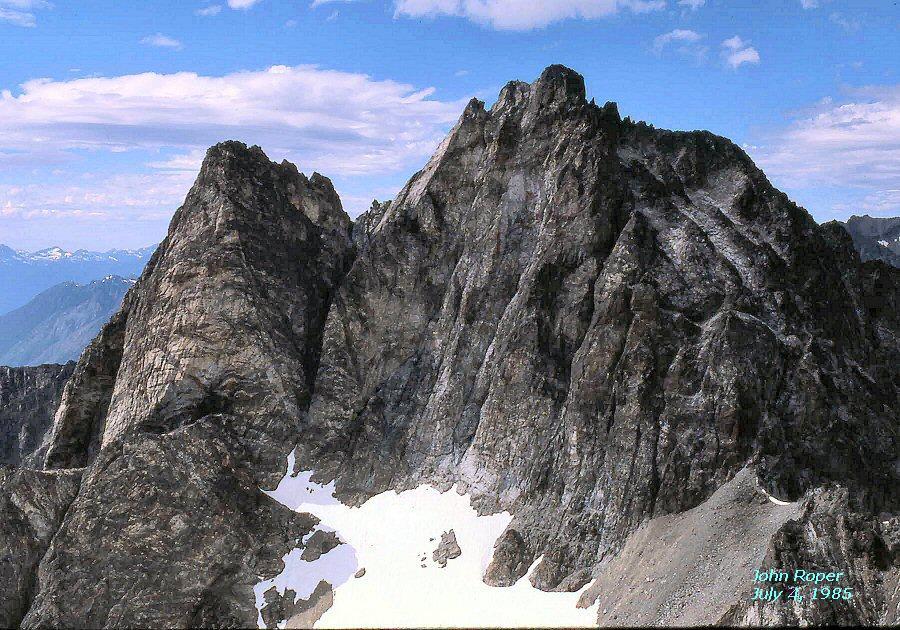
Senior Operator '
on right. Electric Butte' on left, Wireman' in center.
April 2, 1981
FA Party: JR and Silas Wild
The Machinist'
on right. Electric (L), Wireman (C), Senior Operator (RC)
April 2, 1981
FA Party: JR and Silas Wild

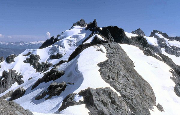
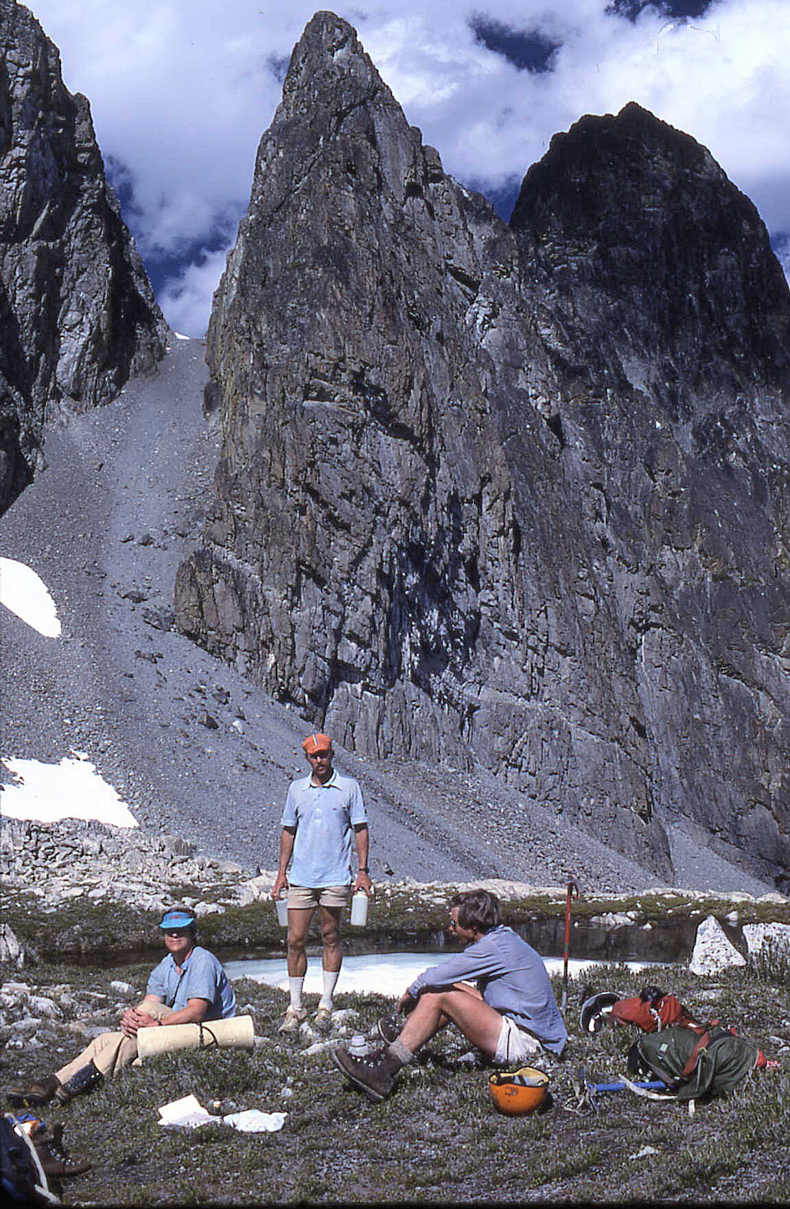
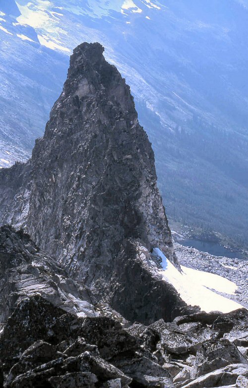
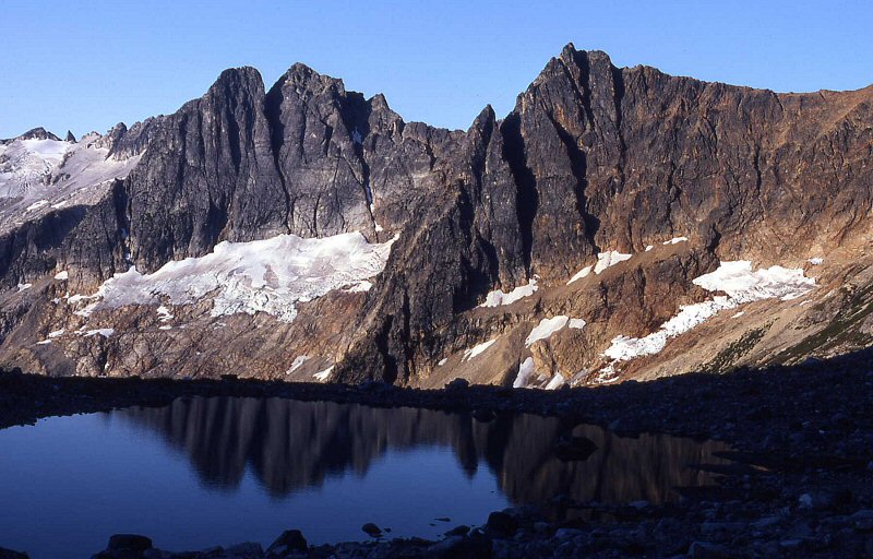
Styloid Peak'
May 31, 1981
FA Party: John Roper, Charlie Janeway, Ted Hegg, Dave Stonington, Ron Aronoff, Don Avriett
of the Group Health Alpine Society (GHAS)
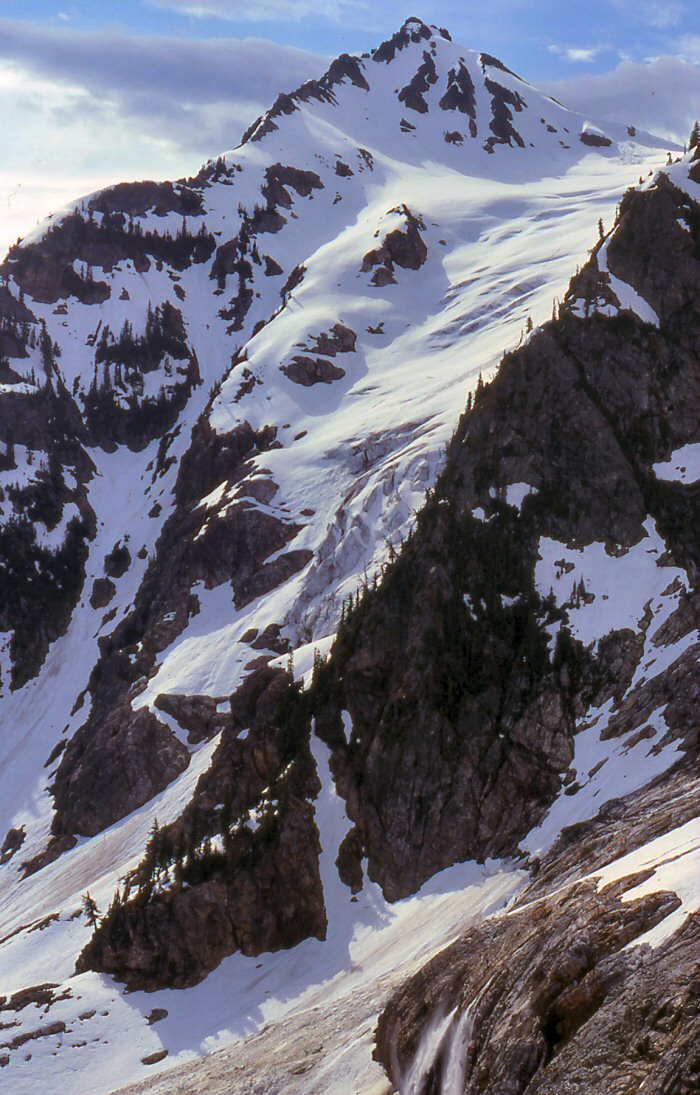
Styloid Peak'
May 31, 1981
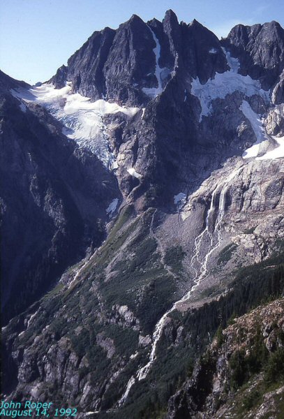
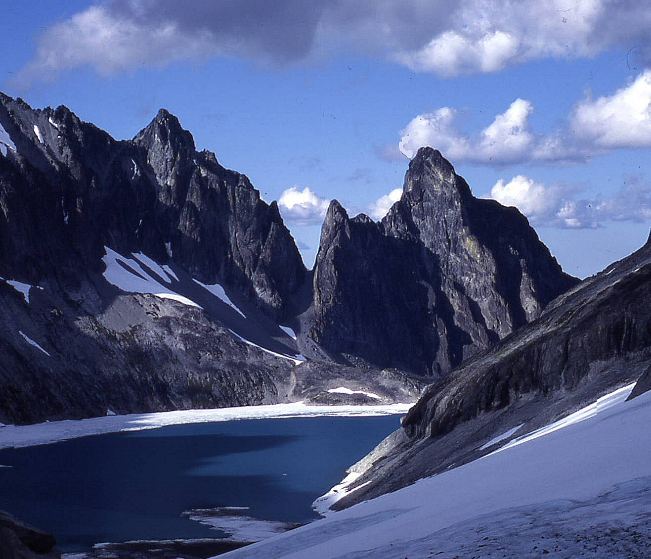
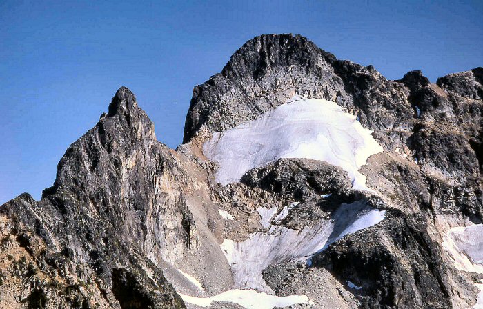
'Distal Phalanx' 7615+
Map of Distal Phalanx.
May 31, 1981
FA Party: John Roper, Dave Stonington, Ted Hegg, and Charlie Janeway (GHAS)
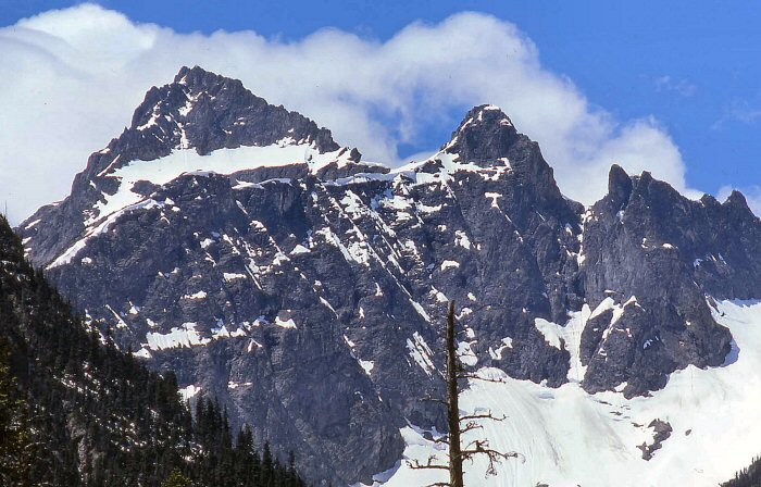
Distal Phalanx is the central climax of the long, untouched north arete above Neve Creek.
[Untouched that is until 27 years later, when one party made a notable try, then the full arete was completed on September 6, 2008. See here.]
"Mantis Peak" climbed by Stan and Marilyn Jensen on 8.16.1973 is the lower twin summit, just left in this photo.
The map labels this eastern, lower, left summit as 7614' and mistakes Distal Phalanx as only 7560+.
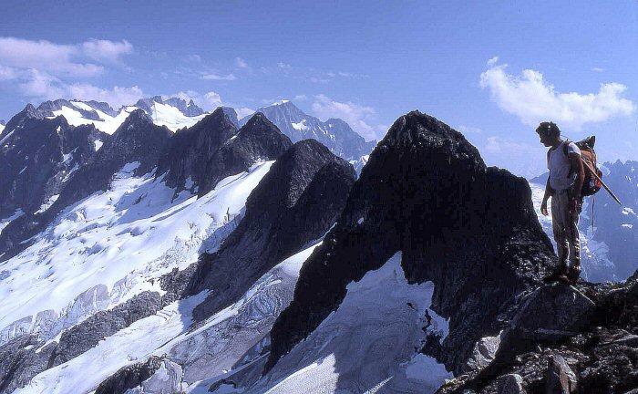
Hook of the Hamate' is the sharp point right of Distal Phalanx (JR solo FA).
The flat-topped summit (Calcaneus') is on the right, above the Neve Waterfall.
Distal Phalanx North Arete is the clean sun-shadow line in center, about 2500-vertical feet of entertainment
Styloid Peak is the rocky peak on left, Tricouni and Primus behind left. Mantis is the lower twin left of Distal Phalanx.
Hook of the Hamate is the point just right of DP. Calcaneus is flat bulk right of H of the H.
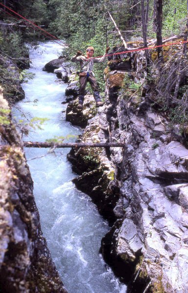
Ted Hegg on a Tyrolean traverse across Thunder Creek
on the approach to Styloid Peak, Distal Phalanx, and Hook of the Hamate.
The traverse was set up by rapping down to the log stuck in the canyon shown in
this photo, crawling across, then climbing the class 4 right wall, and tying off for the shuttle.
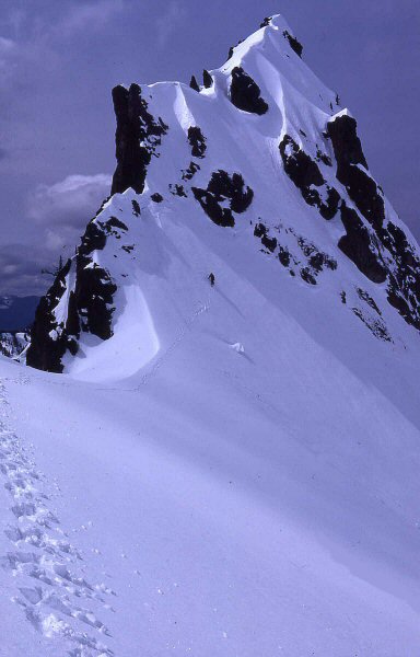
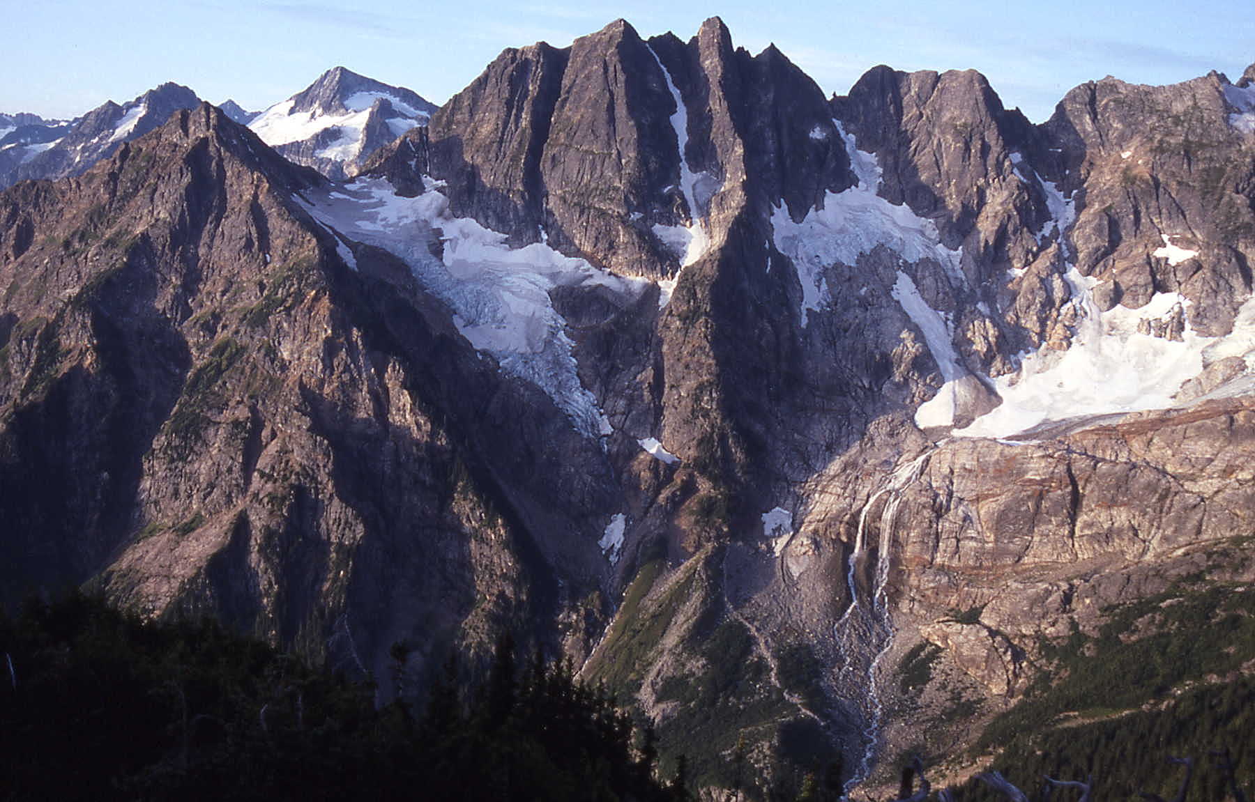
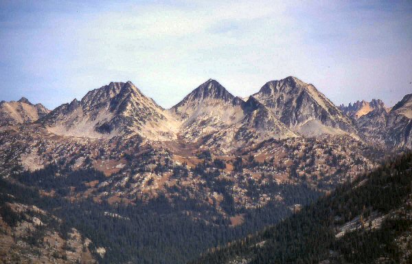
Tara Peak'
Gramps Peak' and Engles Peak' (aka Variation') to right
July 3, 1981
FA Party: John Roper and Gary Mellom
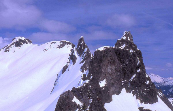
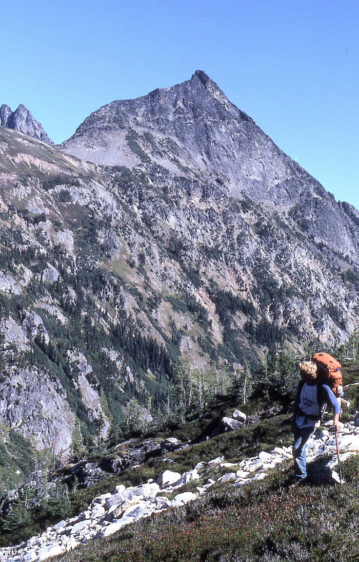
Dirk Peak' 7680+
Center. Stiletto Peak 7600+ on left, Big Stiletto' 7805 on right
July 11, 1981
FA Party: John Roper and John Burroughs
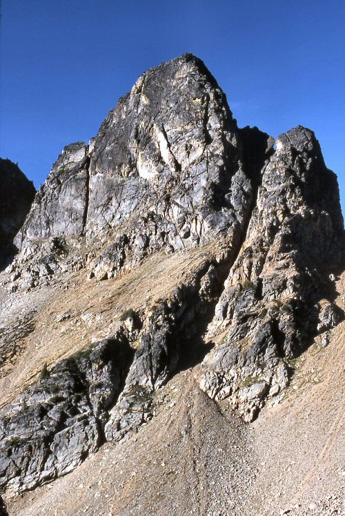
Devils Toothpick'
from Silver Lake is right of the deep V-notch. Devils Tongue" on right.
Rahms Horn'/McNaught Peak" on left.
July 21, 1981
FA Party: John Roper, Jim Lucke and Silas Wild
Devils Toothpick'
from outlet of Silver Lake
I first tried Devils Toothpick in 1970 with Chris Roper and Tom, rowing across Ross Lake from Hozomeen campground, then thrashing up Silver Creek and its gawdawful headwall, but we ran out of time. We got to the notch in the photo above, just below the rock climb of the tower.
Reed Tindall, Rice Johnson, and I walked by the Toothpick in 1971 using the same gawdawful Silver Creek approach into (and out of) bigger prizes in the Chilliwacks.
Finally, Silas Wild, Jim Lucke, and I made it to the top in 1981, coming up Ross Lake on the water taxi, and running the ridge north of Silver Creek, climbing Devils Tongue, then retreating a bit and dropping left beneath the cliffs of Devils Tongue to Silver Lake. Our route from the lake was fairly intuitive. Go up to the notch, then take the path of least resistance, a rightward slant up that west face. Three pitches, the first two easy 5, then a final class 4 pitch.
The Toothpick skewers Silver Lake like a cocktail sausage in this winter aerial photo link by John Scurlock.
W by NW Mox'
to left of NW Mox
July 28, 1981
FA Party: John Roper and Silas Wild
The Sacrum'
Just left of Russ, with the rest of Backbone Ridge from The Coccyx. Eldorado on skyline center.
August 15, 1981
FA Party: John Roper, Russ Kroeker, and Silas Wild
Pancake Pinnacle'
above Purgatory Pond, lower right
August 15, 1981
NEPA Party: John Roper, Silas Wild, and Russ Kroeker
Well, Silas, Russ, and I found no evidence of previous ascent atop, but Matt Perkins, a trustworthy
mountain man alerted me that he was in a party that "accidentally" beat us to this one in 1977. So be it.
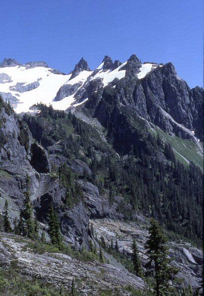
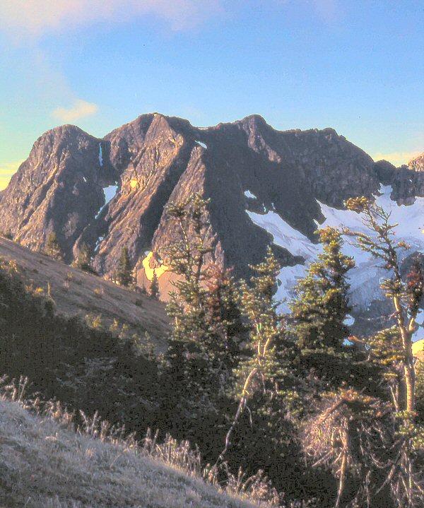
Hoot Owl' South Peak
the prominent right pinnacle. N Hoot Owl is far right.
Black Peak and its NE ridge on right, Black Stax is the rounded summit in center.
August 23, 1981
FA: JR Solo
Hoot Owl' North Peak
to left of Black Stax'
August 23, 1981
FA: JR Solo
Derci Spire'
left of Arriva in center. Fisher Peak on right.
September 14, 1981
FA Party: John Roper and Mark Allaback
Obsession Spire'
This is a subsummit north of Meulfire
September 14, 1981
FA Party: John Roper and Mark Allaback
Natal Peak' 7800+
September 15, 1981
FA Party: John Roper and Mark Allaback (on his 20th birthday)
Zebra Spire'
the sharp central spire above Wyeth Glacier
September 17, 1981
Party: John Roper and Mark Allaback
'V Peak' 8000+
V-notched peak on left. 'Golden Peak' 7880+' on right. 'Zebra Spire' is the sharp spike on left.
September 17, 1981
Party: John Roper and Mark Allaback
Carla Firey and Jim McCarthy climbed the lower left summit of V Peak up the good-looking right buttress in the 70's but may not have gone to the high point as they returned to their camp.
Ezekiel Peak' 7521'
This is the east peak on Elija Ridge. It has 401 feet of prominence before it rises to Elija.
October 25, 1981
JR Solo